Puna Ella Falls
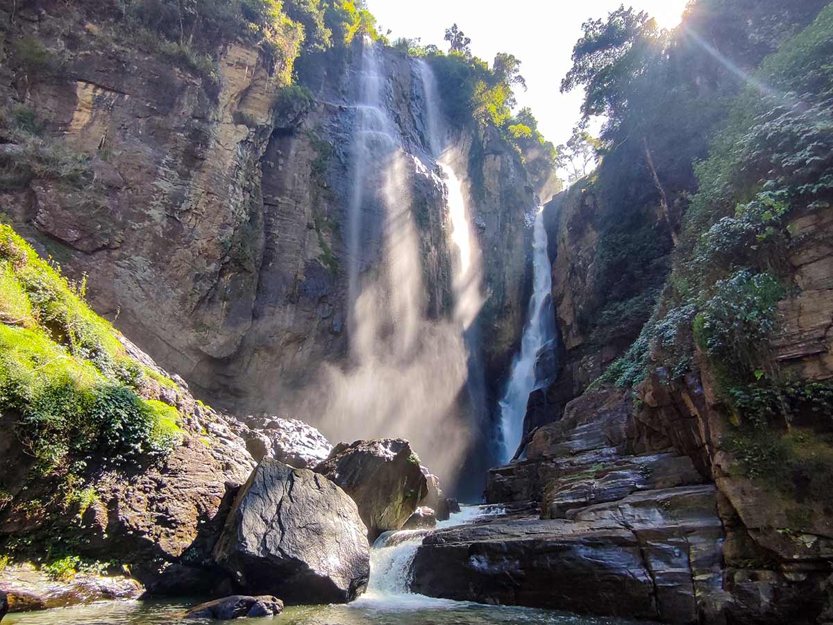
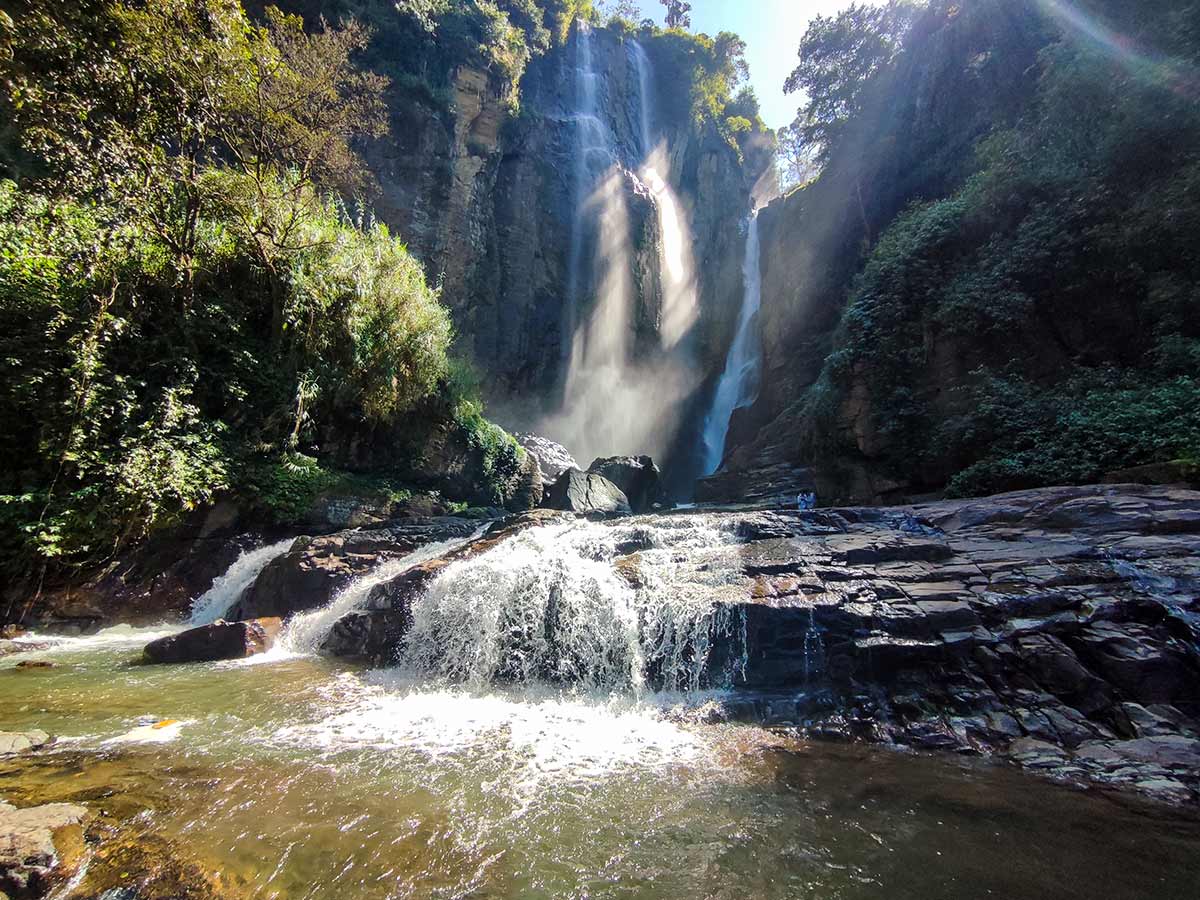
A twin-stream waterfall near Ramboda, documented through original Ceylon Folk photographs of two tall flows descending through separate rock channels.
At a glance
Plan your waterfall visit
Check access effort and viewing conditions first, then review the approach and water-safety notes.
Travel distance
Access difficulty
Best viewing conditions
Access fee
Overview
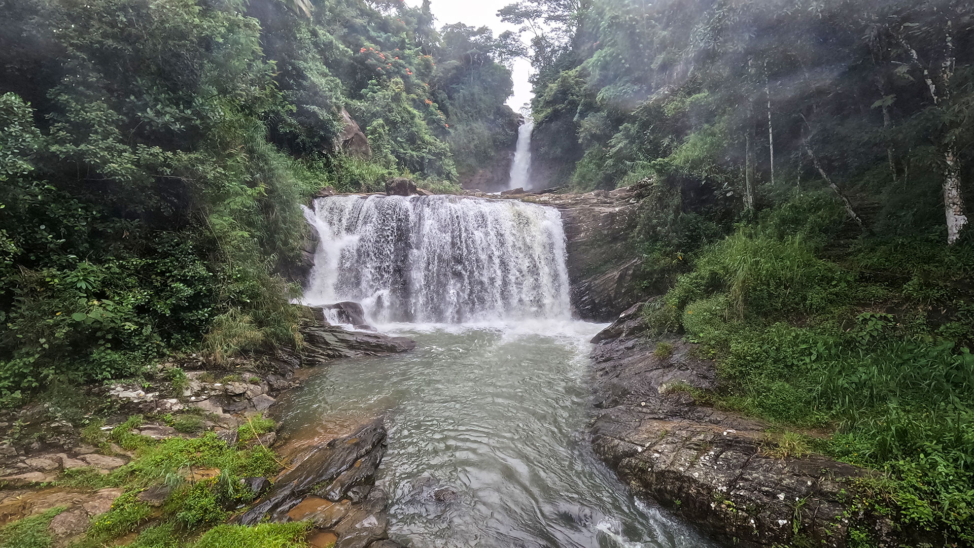
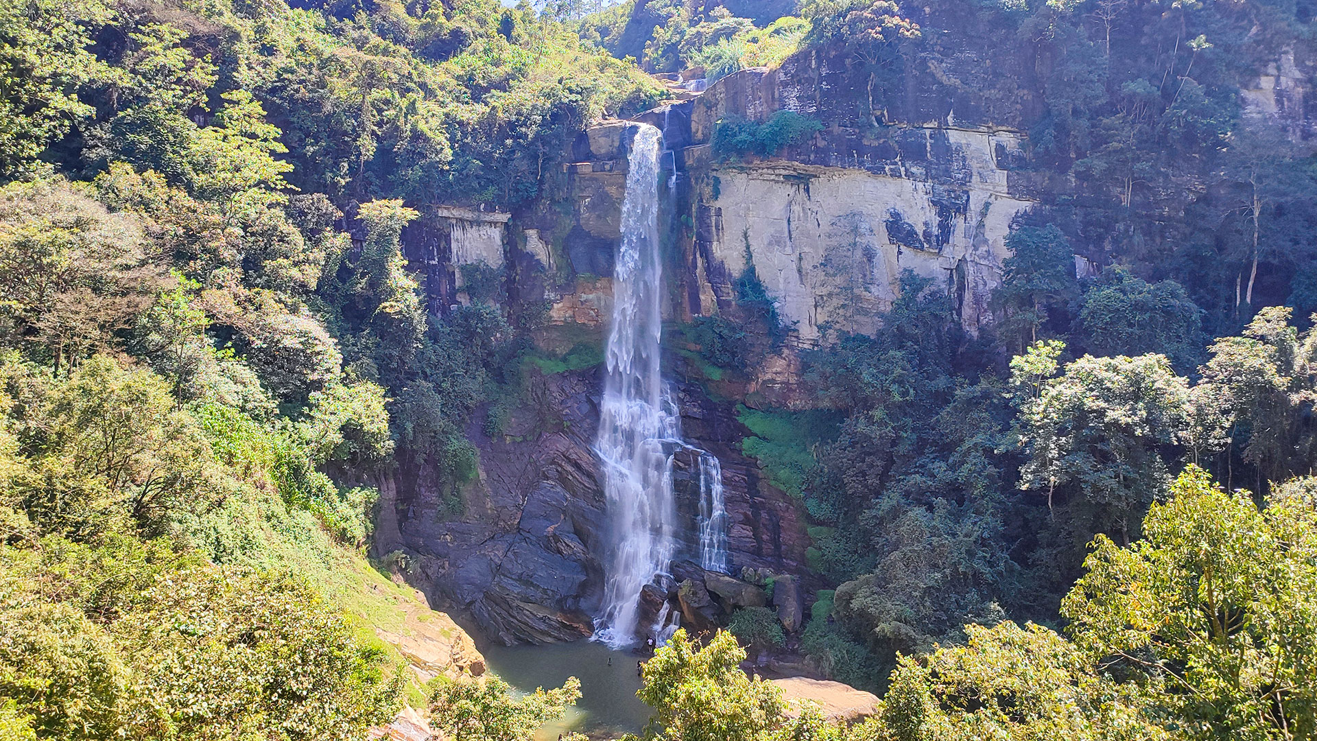
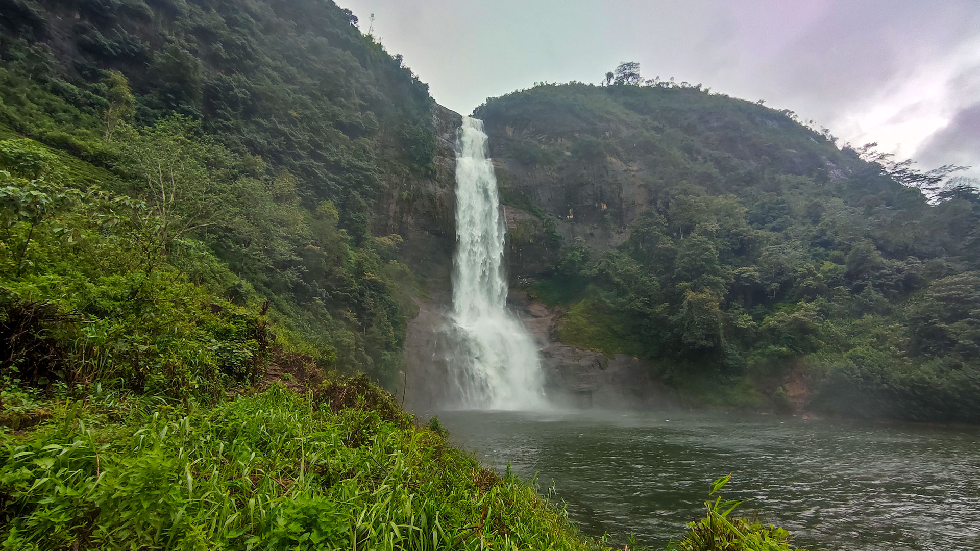
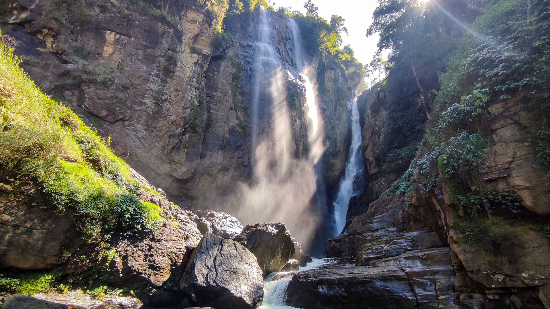
Puna Ella Falls is identified here by its photographed form: two tall streams descend through separate channels in a steep rock amphitheatre, with the visible flows continuing over lower shelves and around large boulders. Original Ceylon Folk photographs and video document this formation from several positions. They provide stronger identity evidence than the name alone because waterfall names around Ramboda are used inconsistently online.
Published references call the formation Puna Ella, Poonawa Ella, and Ramboda Ella. LankaPradeepa identifies Puna Ella in Ramboda and attributes it to Puna Oya. AmazingLanka describes the same photographed twin formation as Ramboda Ella or Puna Ella and places it along the Peradeniya-Nuwara Eliya corridor between Pussellawa and Ramboda. Neither name should be confused with Dunsinane Falls, which is also widely called Pundalu Oya Falls, or with the separate upper, middle, and lower waterfalls carrying the Ramboda name.
The two destination references do not provide one consistent technical account. They publish different height figures, while secondary descriptions disagree on whether the second stream is Pundalu Oya or another branch in the Ramboda water system. Without a primary waterfall survey defining the measured points and both channels, this guide does not present an exact height or assign a definite source to each side. What the original media establishes is the twin-stream structure, not its hydrological boundary.
Both destination references say the waterfall can be seen from the main road or from a distance. Use that wider view first to match the two-channel formation and confirm a safe, permitted place to stop. A visible waterfall is not proof of a public or safe direct path to its base. The start and end coordinates retained on this page record route context from the Ceylon Folk visit; they are not a surveyed trail or permission to cross estate land.
Before leaving the road, show the gallery and map marker to a knowledgeable local person and confirm the current approach, land access, water conditions, and return route. If the image, name, or path does not match, do not continue. Treat the visit as guided path-finding on wet, uneven terrain, allow enough daylight for the full return, and turn back before mist, rain, rising water, or uncertainty makes retreat difficult.
No dependable current source was found for an entrance fee, opening hours, a maintained visitor trail, or safety supervision at the photographed approach. Confirm those conditions locally and do not use close-range photographs as evidence that climbing rocks, entering the channels, or reaching the base is safe.
Waterfall planning
Access and viewing conditions
Check the approach, current path conditions, and appropriate starting point before visiting.
- Viewing conditions
- Daylight hours in suitable weather, Only after confirming the correct path locally
- Fees and access
- Confirm locally (Confirm access permission, guide costs, and any current visitor charge locally.)
Location
Ramboda, Nuwara Eliya District, Central Province
Getting to the waterfall
- From Colombo (~149 km • ~5 h)
- Approach through the A5 Gampola-Nuwara Eliya corridor between Pussellawa and Ramboda. First identify the photographed twin cascade from a safe public road position and confirm where stopping is permitted.
- Before leaving the road, show the original gallery and map marker to a knowledgeable local person. Confirm the current foot approach, land access, water conditions, and return route rather than navigating directly toward the waterfall coordinate.
Choose an approach
Select a marker to open that location in Google Maps.
Waterfall safety
Review these water, weather, and access notes before visiting
- Footpaths are not clearly marked.
- Terrain can become slippery during and after wet weather.
- Do not approach exposed edges, enter moving water, or climb wet rocks.
- Share the route and expected return time with a trusted contact.
- Turn back when the route, identity, weather, visibility, or local advice remains uncertain.
Travel Tips
- Use a knowledgeable local guide to confirm the waterfall identity and safest current path.
- Do not rely on the name alone; confirm that directions are not for Ramboda Falls or Dunsinane Falls.
- Wear footwear suitable for wet, uneven terrain and carry sufficient drinking water.
- Visit with sufficient daylight and postpone the walk during heavy rain, mist, or unsafe local conditions.
Scenic video
Experience the destination
Gallery
Where to go next
Continue planning
These suggestions use reviewed itineraries, routes, and travel groupings. Map closeness alone does not prove direct road or trail access, especially across mountain terrain. Check each guide's Access section before combining stops.