Bellwood Viewpoint (Muthukelina Wewa)
A grassy observation ridge above Muthukelina Wewa in the Bellwood area, overlooking forested slopes and layered Kandy highlands.
At a glance
Plan your viewpoint visit
Check access effort and visibility conditions first, then review the safest available approach.
Travel distance
Access effort
Best visibility
Access fee
Overview
Bellwood Viewpoint is the grassy observation ridge above Muthukelina Wewa in the Bellwood area of Kandy District. Older field reports and a destination reference use the name Muthukelina Wewa for the small mountain lake and describe an observation point immediately above it. The coordinates used on this page are beside the lake, and Ceylon Folk's original approach photograph matches that setting. This is more specific than treating Bellwood as a generic estate or roadside viewpoint.
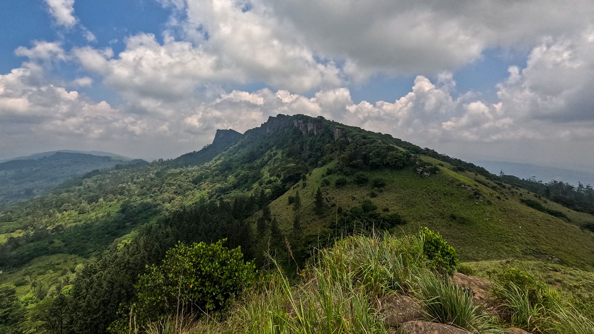
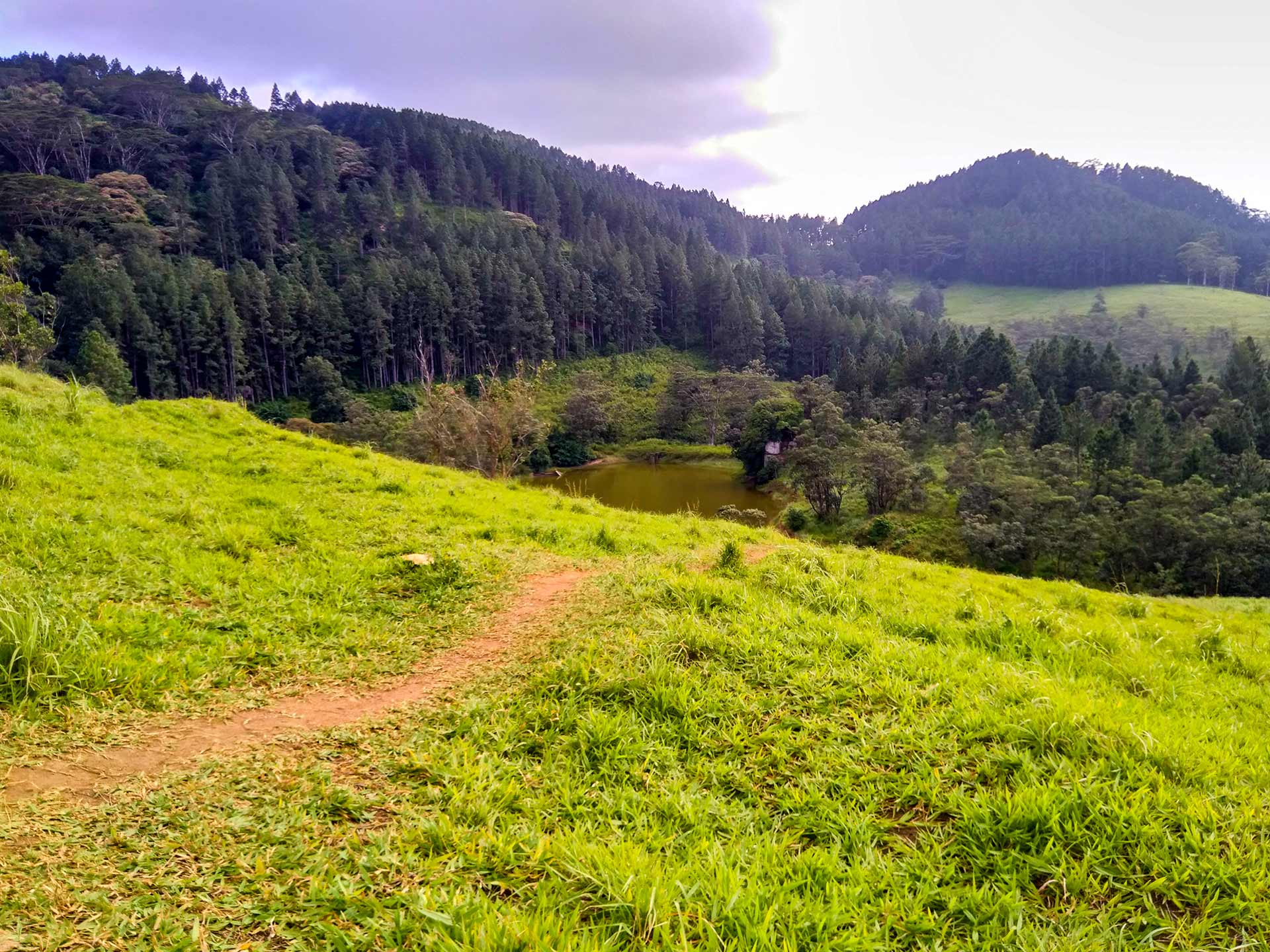
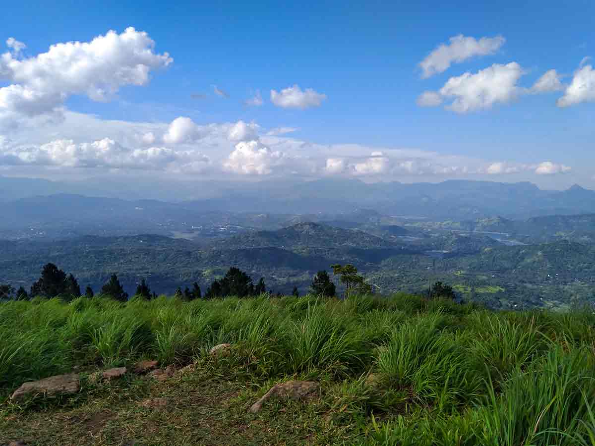
The first photograph records a narrow earth path crossing bright grass toward the lake. Dense stands of tall trees fill the slopes behind the water, while a smoother green clearing breaks the darker forest on the opposite hill. The second photograph shows the character of the upper viewpoint: long grass at the edge of an open ridge, then a broad succession of cultivated land, settlements, wooded hills and distant mountain silhouettes under a large sky. Visibility changes with cloud and haze, so named distant features may not be identifiable on every visit.
Supporting field reports place Muthukelina Wewa at roughly 1,000-1,100 metres and describe views toward the Victoria Reservoir, Thalathuoya side and the Knuckles area. Those directions help explain the breadth of the panorama, but they are observations from earlier visits rather than a surveyed viewpoint diagram. Ceylon Folk therefore does not label individual peaks or promise a complete 360-degree view from every permitted standing point.
The viewpoint is not presented here as a formally operated attraction. Ceylon Folk found no dependable official notice publishing current opening hours, an entrance fee, parking arrangements, toilets or unrestricted public access. The approach passes through rural and potentially managed land, and older reports describe variable road conditions. A recent local travel account also reported posted notices prohibiting camping. Treat gates, signs and instructions from residents or land managers as the authority on the day; do not assume that online listings showing 24-hour opening or free entry establish a legal right of access.
Approach in suitable-weather daylight and confirm the final road, permitted stopping place and walking line locally. The two Ceylon Folk photographs establish a grassy path and exposed upper ridge, but not that every vehicle can reach them. Park without blocking the narrow road and continue only on an established, permitted path. Long or wet grass can hide uneven ground, and the upper slope has no visitor infrastructure visible in the original photograph.
Keep out of the lake, stay back from steep or concealed edges and carry all waste out. If cloud, rain or wind makes footing or orientation uncertain, return by the same confirmed route. These photographs document what Ceylon Folk encountered during the visit; they do not guarantee today's access, surface, water level or weather.
Viewpoint planning
Access and visibility planning
Check visibility, current access conditions, and the appropriate approach before travelling.
- Visibility and conditions
- Clear daylight, When local access is confirmed
- Fees and access
- Confirm locally (No dependable official fee, opening-hours or access notice was found. Confirm permission and any current charge locally before visiting.)
Location
Muthukelina Wewa, Bellwood area, Kandy District, Central Province
Getting to the viewpoint
- From Colombo (~130 km • ~4 h via Kandy)
- From the Kandy side, use the established approach through Talathuoya toward Bellwood, then confirm the current final branch to Muthukelina Wewa locally rather than relying on an older turn-by-turn description.
- At the lake area, identify a clearly permitted stopping place without blocking the narrow road and ask whether visitors may continue to the observation ridge.
- Reach the viewpoint only by the established grassy path approved locally; return the same way if a gate, sign, resident or land manager restricts access.
Choose an approach
Select a marker to open that location in Google Maps.
Viewpoint safety
Review these access and viewpoint notes before visiting
- The rural approach can be narrow and its condition can change; do not continue in a vehicle that cannot be parked or turned safely.
- Stay on the permitted path and respect gates, signs, residents and managed land throughout the approach.
- Long grass can conceal uneven ground and the upper ridge may have unprotected edges; keep well back from any drop or uncertain footing.
- Avoid the ridge during heavy rain, thunderstorms, strong wind or poor visibility, when grass and exposed ground may be unsafe.
- Do not enter the lake or assume its banks, depth or water quality are suitable for swimming.
Travel Tips
- Ask locally for Muthukelina Wewa and the observation ridge, because Bellwood can refer to a wider area rather than one signed attraction.
- Confirm the final road, parking position and walking permission before leaving the last settled checkpoint.
- Visit in suitable-weather daylight and allow time to return before cloud or darkness makes the grassy approach difficult to follow.
- Carry water and essential supplies because facilities at the lake and viewpoint have not been independently verified.
- Treat camping as prohibited unless the responsible land manager explicitly states otherwise; a 2026 local visit report documented no-camping notices.
Gallery
Where to go next
Continue planning
These suggestions use reviewed itineraries, routes, and travel groupings. Map closeness alone does not prove direct road or trail access, especially across mountain terrain. Check each guide's Access section before combining stops.